


During the late nineteenth and early twentieth centuries, many artists and adventurers came to regard the Polar Regions as the final frontier on earth. A series of explorers from Great Britain, Norway, the United States, and, eventually, the Soviet Union struggled to survive these treacherously cold climates and cross the icy terrains to reach the Poles. Unlike explorers of the American West, these expedition leaders did not intend to colonize the Polar Regions or establish tourist destinations on the model of Yellowstone. Instead, they sought to discover potential trade routes and natural resources, as well as to advance scientific knowledge and promote national pride.
Polar explorers sought to discover potential trade routes and natural resources, as well as to advance scientific knowledge and promote national pride.
Today, the Arctic Region includes a mostly ice-covered ocean, the North Pole, the island of Greenland, and parts of Canada, Alaska, Russia, Iceland, and Norway. From the sixteenth century on, European and Russian monarchs funded expeditions to find an Arctic passage to the Pacific Ocean and China. While no commercially viable route was ever established, these expeditions found previously unknown islands and coasts and made contact with the Inuit people. The Norwegian Roald Amundsen led the first successful navigation of the Northwest Passage, connecting the Atlantic and Pacific Oceans, in 1903–1905. U.S. Navy engineer Robert Peary reported that he reached the North Pole in 1908–1909. However, his claim continues to be contested. The first undisputed walk on the North Pole did not occur until 1948, when a Soviet expedition reached it by plane.
The Antarctic Region consists of a large, glacier-covered land mass, and includes the South Pole. It does not belong to any country or include any indigenous, or native, people. During the nineteenth century, British, American, Scottish, and Norwegian expeditions explored the region primarily for seal and whale hunting. In 1911, Amundsen became the first person to reach the South Pole. Although many countries sent expeditions following his, the way remained extremely difficult and dangerous for decades. Since the mid-twentieth-century, the Antarctic has been managed by international treaty and reserved for scientific study.

The following collection of documents includes five works of art, each offering a different approach to the representation of Polar exploration, from a first encounter between Europeans and Inuit to a vast arctic landscape to the scientific examination of the natural world to the celebration of the explorer as national hero. This collection can be studied in conjunction with Art and Exploration in the American West and Mexico.
Please consider the following questions as you review the documents
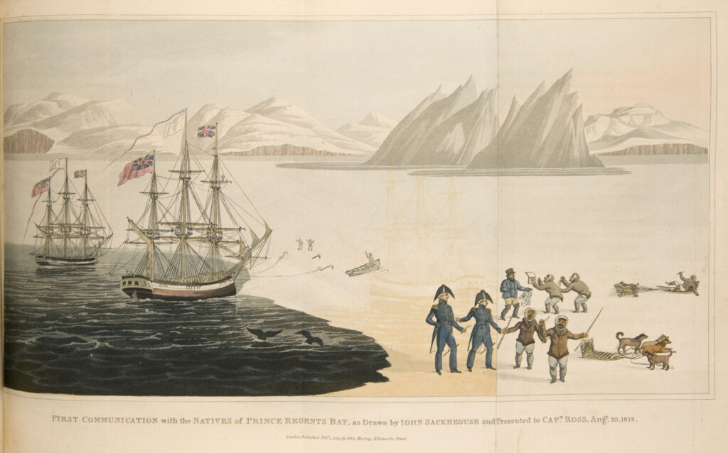
“First Communication with the Natives” is a drawing created by John Sacheuse (sometimes spelled Sackhouse). Sacheuse was an Inuk from Greenland, who had been rescued in a storm by an English ship years earlier and had subsequently learned English and converted to Christianity. He acted as interpreter during Royal Navy officer John Ross’s unsuccessful 1818 expedition to discover the Northwest Passage. Ross included this drawing in his book describing the journey. The drawing portrays people in Prince Regents Bay, an inlet of Baffin Bay, located along the southwest coast of Greenland.
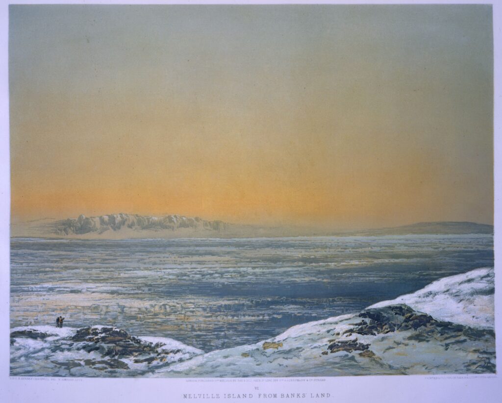
During the mid-nineteenth century, British naval officer Samuel Gurney Cresswell participated in two Arctic expeditions and created a number of watercolor paintings, which were reproduced as lithographs and published in London in 1854. This painting portrays Banks and Melville Islands, part of the Canadian Arctic Archipelago in the Northwest Territories of Canada.
Questions to Consider

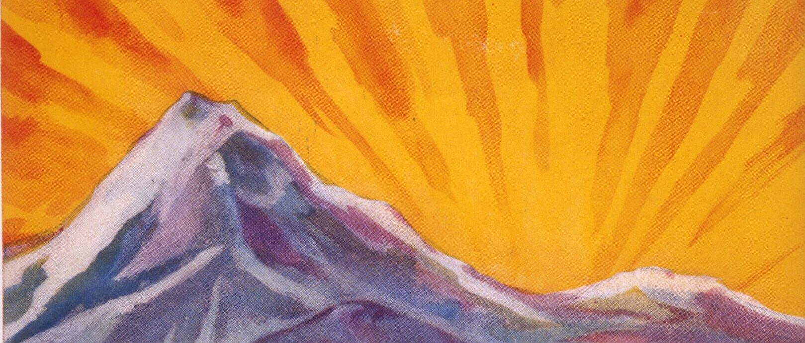
Edward Wilson accompanied Ernest Shackleton and Robert Falcon Scott to the Antarctic in 1902–1903. This illustration appeared in the South Polar Times, a newspaper that Wilson and Shackleton produced during the expedition. Wilson died with Scott and others returning from the pole during a second expedition in 1912.
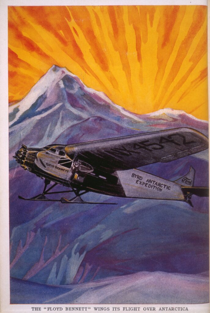
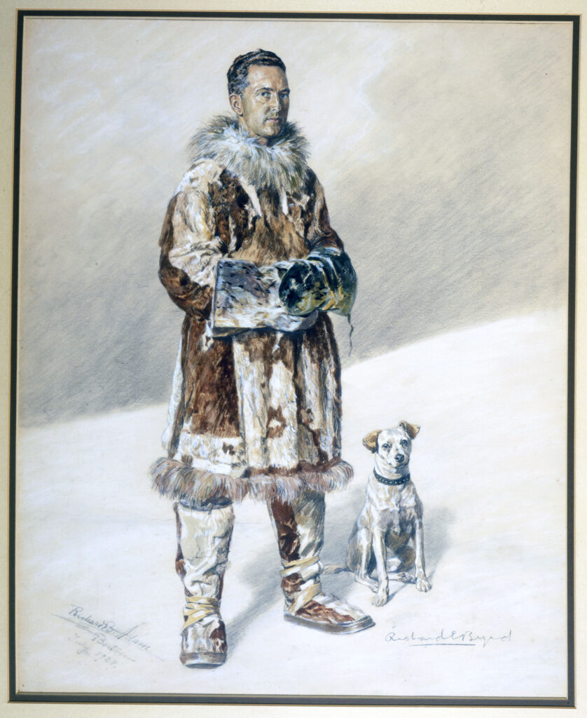
Richard E. Byrd was a U.S. naval officer who, in 1929, became the first person to fly to the South Pole and back. Byrd arrived in Antarctica by ship and established a base camp on the ice shelf. From there, he and a 3-person crew took the more than 18-hour, round-trip flight to the South Pole and back. Byrd became a national hero. The plane he flew was named the Floyd Bennett, after a recently deceased pilot and friend, who had flown with Byrd on previous Arctic and transatlantic trips.
Questions to Consider
David C. White and Patrick Morris, comps., and Robert W. Karrow, Jr., ed. The Gerald F. Fitzgerald Collection of Polar Books, Maps, and Art at the Newberry Library: A Catalogue. 2000.
Princeton University Library. Of Maps and Men: In Pursuit of a Northwest Passage: An Online Exhibition of Maps, Books, Artwork, and Photographs. 2004. http://libweb5.princeton.edu/visual_materials/maps/websites/northwest-passage/titlepage.htm.