


Themes
Chicago History
Immigration
Settlement Houses
Periods
19th Century
20th Century
Progressive Era
Skills & Document Types
Maps
Close Reading
Visual Literacy
Materials – Available for Download in the Downloads Tab:
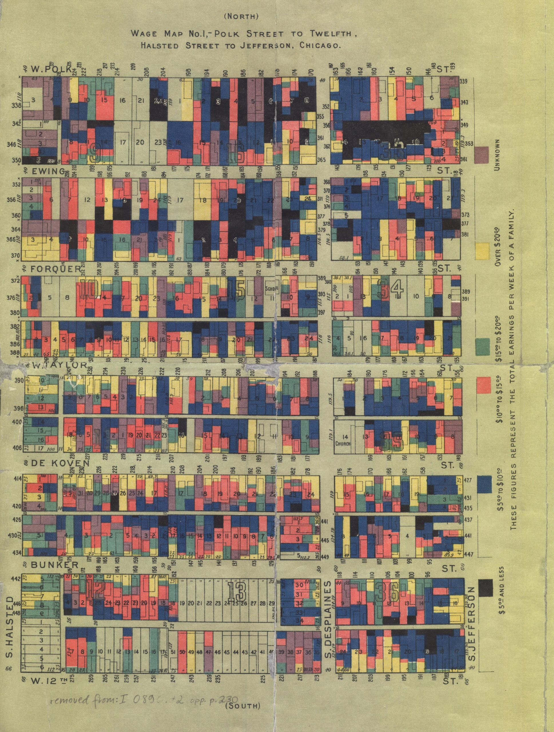
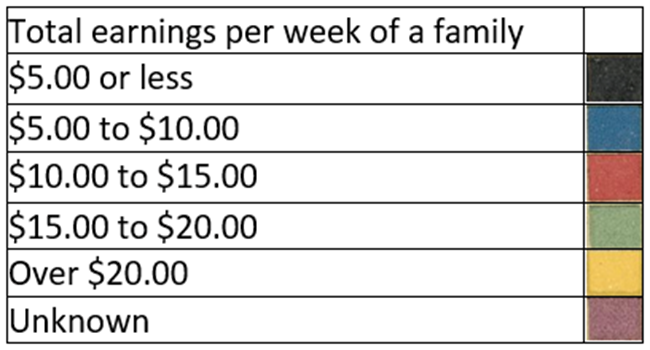
You and your students will examine two maps created by the staff of Chicago’s Hull House in 1895. You will encourage students to get as much information as they can from each map and both maps together, using a two-step process. First, identify questions the maps might answer. Second, try to answer the questions.
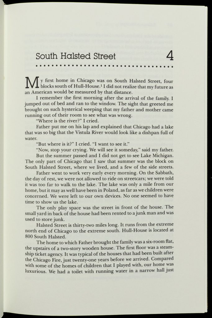
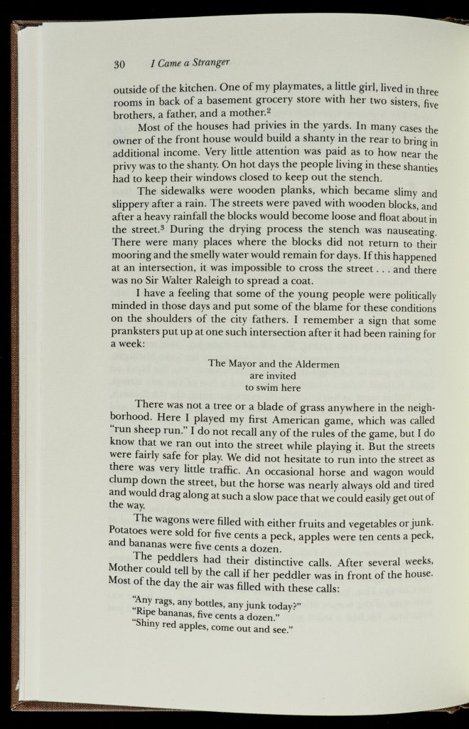
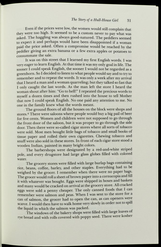
After you have looked at both maps, you will read a short excerpt from an autobiography called I Came a Stranger: The Story of a Hull House Girl, by Hilda Satt Polacheck, which describes life in the neighborhood shown on the maps.
Use the background material at the end of the second and third sources whenever you think it will encourage students to ask more questions and engage more effectively.
Click on the image for a high-resolution version that can be displayed for your class.

While looking at this map, which shows the neighborhood around Hull House, ask students to come up with questions they might be able to answer using the information they can get from the map. Then ask them to give you questions they could not answer about the neighborhood by looking at the map.
For more advanced students, provide no additional background information at first, Let them figure out everything they can on their own. For younger students, provide whatever background you think will help them, but try not to give them information they can figure out relatively easily on their own.
This can be a whole-class activity, or you can divide the class into groups. The latter may give more students the opportunity for active participation. If you have students that thrive on competition, you can make it a contest. The following are some questions your students might generate. You can use them to model the process for your students. You can also ask students these questions yourself if, in your judgment, the students need more help.
What questions could you answer using this map?
What questions cannot be answered with this map?
You can provide students with this information or challenge them to find it themselves.
According to the inflation calculator at www.in2013dollars.com:
$5 in 1895 was equivalent in purchasing power to about $157.66 today.
$20 in 1895 was equivalent in purchasing power to about $630.66 today.

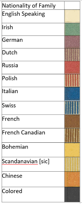
While looking at the second map, it’s important to point out that we would no longer use “nationality” to describe ethnic groups in the United States. “Ethnicity” would be a better label for this map. Also, instead of “Colored,” we would use Black or African American. You might also want to discuss with students the significance of not including African Americans and Irish Americans in the category “English speaking.” (Did the mapmakers use this term to refer to non-minorities, that is, white people who were born in the United States?)
When you show students this second map, ask them to come up with questions they might be able to answer using the information they can get from this map and the first map put together. Then ask them to give you questions they could still not answer about the neighborhood by looking at both maps.
What new questions can be answered with this map?
What questions cannot be answered with this second map?
Jane Addams and Ellen Gates Starr founded Hull House, Chicago’s first settlement house, in 1889. At one point, Hull House conducted a study of the people who lived in its Near West Side neighborhood. Many of them were recent immigrants, who came primarily from central, southern, and eastern Europe. These maps appeared in the volume Hull-House Maps and Papers, which was published in 1895.
For more background, read the entry “Hull House,” by Mary Ann Johnson in the Encyclopedia of Chicago.
The excerpt provides information in a very different form from that of the maps. You may read it aloud or have students read it themselves. Or you might have students take turns reading it aloud to the class.
What questions could you answer using this excerpt?
Ask students what questions are still left unanswered and where they might find more information to answer those questions.
Hilda Satt Polacheck (1882-1967) came to Chicago from Poland with her family in 1892. The family settled in Chicago, in what was called the Near West Side neighborhood. Young Hilda became active at Hull House and wrote about the place and the neighborhood around it in her autobiography, which was published after her death.
There are many more books about Hull House in the Newberry Library General Collection on the 2nd floor of the library, including:
From Hull House Maps and Papers, New York: T.Y. Crowell & Co., c. 1895
Sources in this lesson also appear in the Collection Essays Faith in the City: Religion and Urban Life in Chicago, 1870-1920, Chicago Workers during the Long Gilded Age, and Immigration and Citizenship in the United States, 1865-1924.
Download the following materials below: