Curriculum Connections: American Imperialism, Colonial & Revolutionary Period, Close Reading, Maps, Visual Literacy
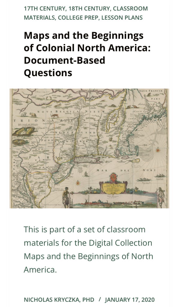
This is part of a set of classroom materials for the Digital Collection Maps and the Beginnings of North America. Find the rest in the Related Resources tab.
Activity Context and C3 Framework
In the context of a grade 9-12 level social studies classroom, the activity below can be used in conjunction with the following C3 Framework for Social Studies State Standards.
D2.His.1.9-12. Evaluate how historical events and developments were shaped by unique circumstances of time and place as well as broader historical contexts.
D2.His.4.9-12. Analyze complex and interacting factors that influenced the perspectives of people during different historical eras.
D2.His.5.9-12. Analyze how historical contexts shaped and continue to shape people’s perspectives.
D2.His.9.9-12. Analyze the relationship between historical sources and the secondary interpretations made from them.
D2.His.11.9-12. Critique the usefulness of historical sources for a specific historical inquiry based on their maker, date, place of origin, intended audience, and purpose.
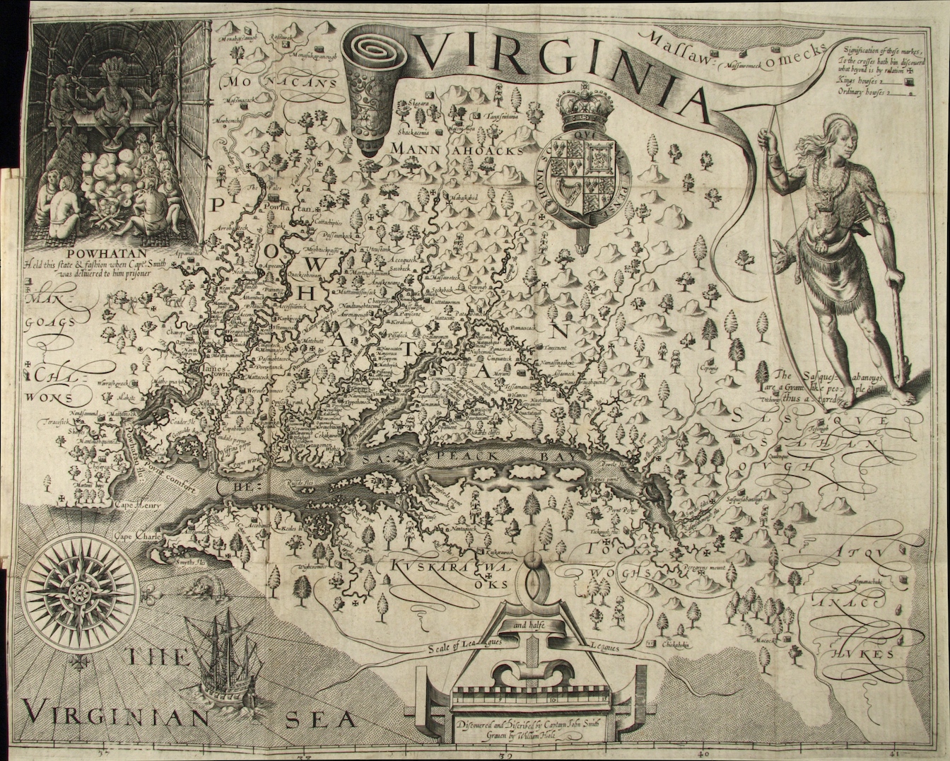
Having found their entries, students will read the relation and track the following information:
Now, pass students a copy of the map made by John Foster from the same book and instruct them to locate the villages on the map.
Next, have students find the three numbered locations that occurred closest to their event, and form a group with the students that had those numbers.
Next, have the newly formed groups of three or four students explain to each other what happened at their location, and connect the events together in terms of chronology, geography, or type of incident. Ask students to consider:
Is your event near someone else’s on the map?
Did your event happen within the same days or weeks as someone else’s?
Do the details of what happened in your event sound similar to someone else’s?
Having established an interpretation of their corner of the map, instruct students to give an answer to this question:
What does the map made by John Foster clarify about the conduct of the war that you did not understand by looking at the narrative alone?
About the Author
Nicholas Kryczka is a Postdoctoral Fellow in the Social Sciences and the Department of History at the University of Chicago. He teaches coursework in American Civilization, urban history, and oral history and conducts research on the history of post-civil rights school reform in Chicago. Previously, Nick worked for a decade as a high school social studies teacher in the Chicago Public Schools.