Curriculum Connections: American Imperialism, Argumentative Writing, Colonial and Revolutionary History, European Imperialism, Maps, Native American and Indigenous History, Visual Literacy
Download copies of the DBQs in the Downloads tab.
Document-Based Question 1
Using the set of primary documents below, write a thesis-driven essay that answers the following question:
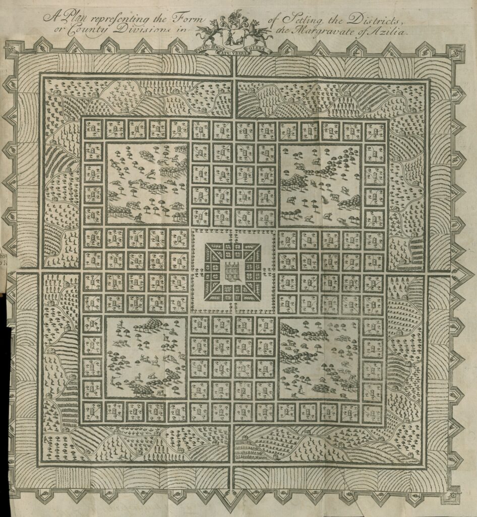
Evaluate how differing perceptions and systems of land organization held by Europeans and North American Indians shaped encounters and conflicts during the colonial era.
Documents:
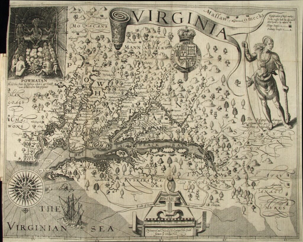
- John Smith, Virginia / Discouered and Discribed by Captayn John Smith, 1612. (Full map.)
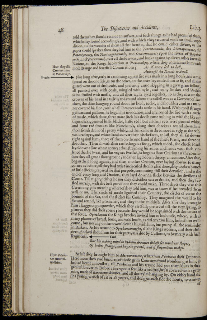
- John Smith, [Excerpt] The Generall Historie of Virginia, New-England, and the Summer Isles: With the Names of the Adventurers, Planters, and Governours from Their First Beginning anno 1584 to This Present 1626…, 1627.
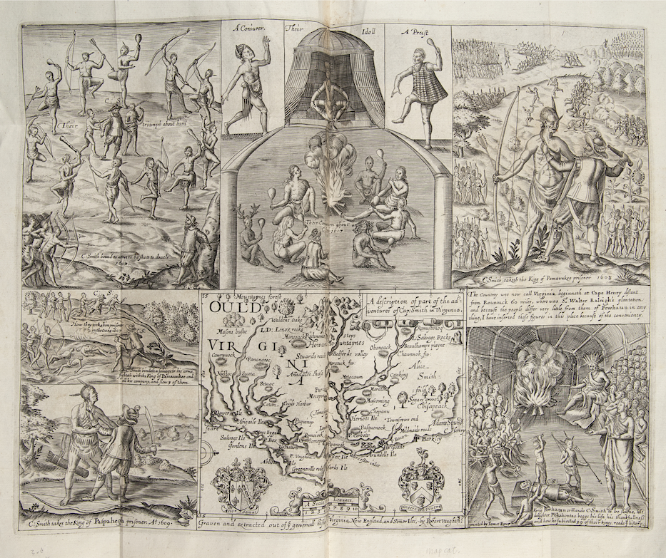
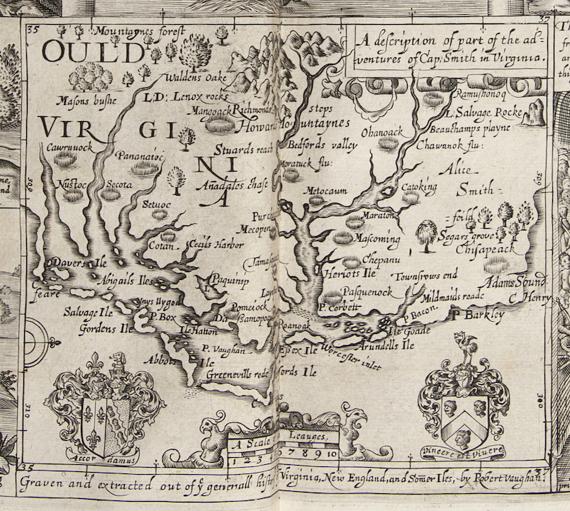
- Robert Vaughan, [engraving] “A Description of Part of the Adventures of Capt. Smith in Virginia,” from The Generall Historie of Virginia, New-England, and the Summer Isles: With the Names of the Adventurers, Planters, and Governours from Their First Beginning anno 1584 to This Present 1626: With the Proceedings of Those Severall Colonies and the Accidents, by John Smith, 1627. (Full engraving.)
- Sir Robert Montgomery, “A Plan Representing the Form of Setling the Districts, or County Divisions in the Margravate of Azilia,” From A Discourse Concerning the Design’d Establishment of a New Colony to the South of Carolina, in the Most Delightful Country of the Universe, 1717.
Document-Based Question 2
Using the documents below, write a thesis-driven essay that answers the following question:
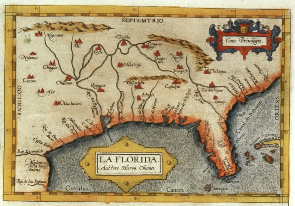
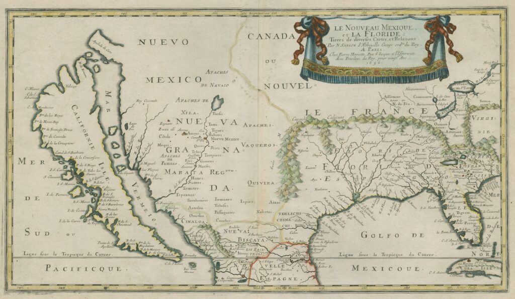
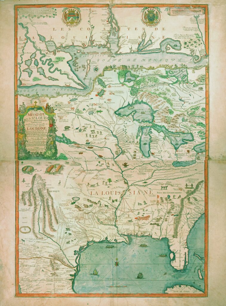
Analyze how Europeans’ knowledge of the North American continent changed between the sixteenth and eighteenth centuries.
Documents:
- Geronimo Chaves, “La Florida,” From Theatrvm orbis terrarvm opus nunc tertio ab ipso auctore recognitum, multisque locis castigatum, & quamplurimis nouis tabulis atque commentarijs auctum, by Abraham Ortelius, 1584.
- Nicolas Sanson, Le Nouveau Mexique, et La Floride: tirées de diverses cartes, et relations [New Mexico and Florida: from various maps and relations], 1656.
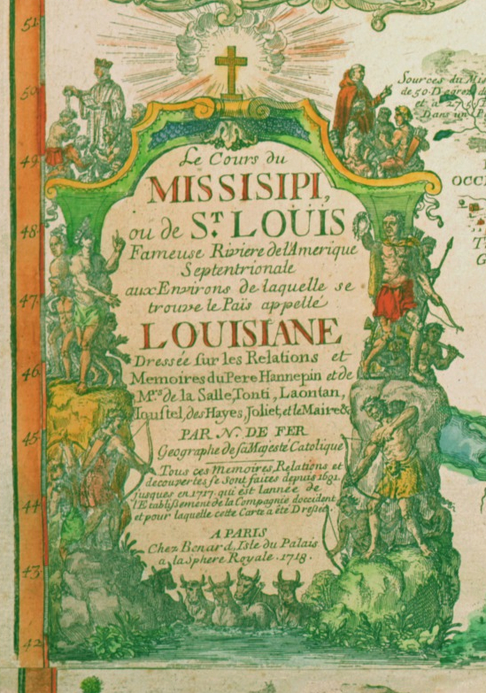
- Nicolas de Fer, Le cours du Missisipi ou de St. Louis fameuse riviere d’Amerique Septentrionale… [The Course of the Mississippi, or the St. Louis, the famous river of North America], 1718. (Full map.)
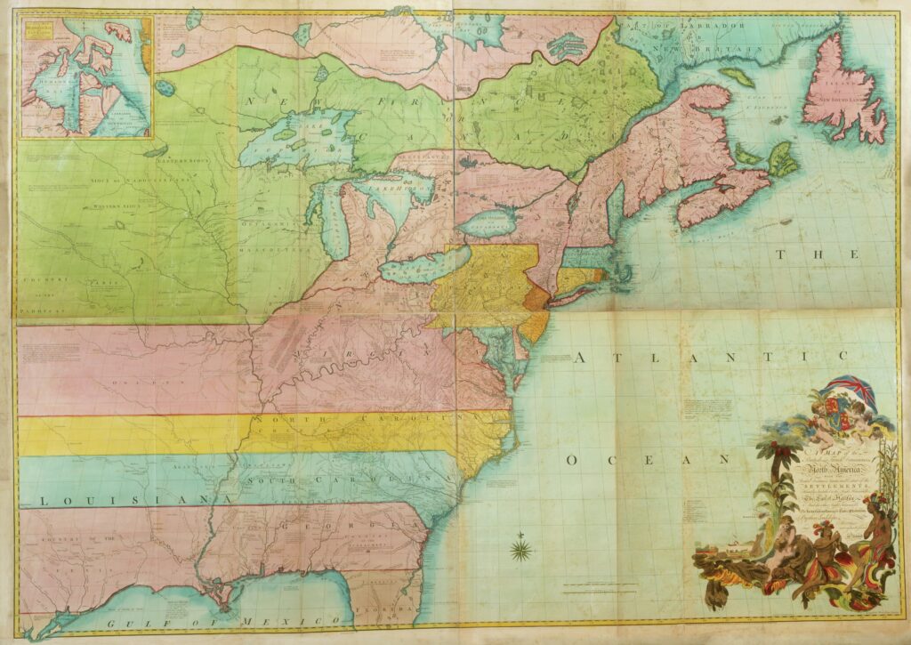
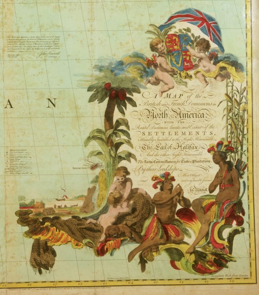
- John Mitchell, “A Map of the British and French Dominions in North America: With the Roads, Distances, Limits, and Extent of the Settlements…,” 1755. (Full map.)
Document-Based Question 3
Using the documents below, write a thesis-driven essay that answers the following question:
Describe the motives that European colonial powers brought to their efforts to map North America. Assess the implications that their new knowledge had for warfare—both between Indians and Europeans, and among European powers—in the seventeenth and eighteenth centuries.
Documents
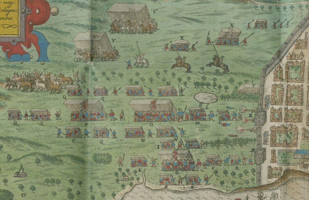
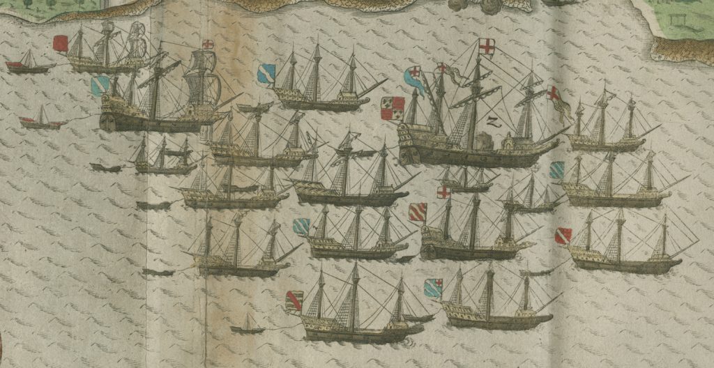
- Baptista Boazio, “Civitas S. Dominici sita in Hispaniola [City of S. Domingo located in Hispaniola],”. From Expeditio Francisci Draki Eqvitis Angli in Indias Occidentales a. M.d. Lxxxv. Quâ Vrbes, Fanum D. Iacobi, D. Dominici, D. Augustini & Carthagena, Captae Fuêre. Additis Passim Regionum Locorúmque Omnium Tabulis Geographicis Quàm Accuratissimis, by Walter Bigges. 1588. (Detail of battle.)
- Robert Vaughan, [engraving], “A Description of Part of the Adventures of Capt. Smith in Virginia,” From The Generall Historie of Virginia, New-England, and the Summer Isles: With the Names of the Adventurers, Planters, and Governours from Their First Beginning anno 1584 to This Present 1626: With the Proceedings of Those Severall Colonies and the Accidents, by John Smith. 1627. (Full engraving.)
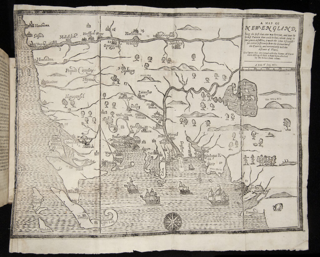
- John Foster, “A Map of New-England, Being the First That Ever Was Here Cut, and Done by the Best Pattern That Could Be Had, Which Being in Some Places Defective, It Made the Other Less Exact: Yet Doth It Sufficiently Shew the Scituation of the Country, and Conveniently” From A Narrative of the Troubles with the Indians in New-England, from the First Planting Thereof in the Year 1607 to This Present Year 1677 but Chiefly of the Late Troubles in the Two Last Years, 1675 and 1676 to Which Is Added a Discourse About the Warre wit, by William Hubbard. 1677. (Full map.)
- John Mitchell, “A Map of the British and French Dominions in North America: With the Roads, Distances, Limits, and Extent of the Settlements…, 1755.” (Detail of map title.)
Document-Based Question 4
Using the documents below, write a thesis-driven essay that answers the following question:
Describe the variety of Europeans’ visual depictions of North American Indians during the era of colonial settlement. Evaluate the significance of these depictions within Europeans’ views of exploration, conquest, and settlement.
Documents:
- Baptista Boazio, “Civitas S. Dominici sita in Hispaniola [City of S. Domingo located in Hispaniola],”. From Expeditio Francisci Draki Eqvitis Angli in Indias Occidentales a. M.d. Lxxxv. Quâ Vrbes, Fanum D. Iacobi, D. Dominici, D. Augustini & Carthagena, Captae Fuêre. Additis Passim Regionum Locorúmque Omnium Tabulis Geographicis Quàm Accuratissimis, by Walter Bigges. 1588. (Detail of battle.)
- Robert Vaughan, [engraving], “A Description of Part of the Adventures of Capt. Smith in Virginia,” From The Generall Historie of Virginia, New-England, and the Summer Isles: With the Names of the Adventurers, Planters, and Governours from Their First Beginning anno 1584 to This Present 1626: With the Proceedings of Those Severall Colonies and the Accidents, by John Smith. 1627. (Full engraving.)
- Nicolas de Fer, “Le cours du Missisipi ou de St. Louis fameuse riviere d’Amerique Septentrionale… [The Course of the Mississippi, or the St. Louis, the famous river of North America].” 1718. (Detail of map title.)
- John Mitchell, “A Map of the British and French Dominions in North America: With the Roads, Distances, Limits, and Extent of the Settlements…, 1755.” (Detail of map title.)
Document-Based Question 5
Using the documents below, write a thesis-driven essay that answers the following question:
Why were certain landforms and waterways of strategic importance to European colonial powers as they settled North America during the colonial era?
Documents:
- Baptista Boazio, “Civitas S. Dominici sita in Hispaniola [City of S. Domingo located in Hispaniola],”. From Expeditio Francisci Draki Eqvitis Angli in Indias Occidentales a. M.d. Lxxxv. Quâ Vrbes, Fanum D. Iacobi, D. Dominici, D. Augustini & Carthagena, Captae Fuêre. Additis Passim Regionum Locorúmque Omnium Tabulis Geographicis Quàm Accuratissimis, by Walter Bigges. 1588. (Details of ships and battle.)
- Nicolas de Fer, Le cours du Missisipi ou de St. Louis fameuse riviere d’Amerique Septentrionale… [The Course of the Mississippi, or the St. Louis, the famous river of North America],. 1718. (Detail of map title.)
- John Mitchell, “A Map of the British and French Dominions in North America: With the Roads, Distances, Limits, and Extent of the Settlements…, 1755.” (Detail of map title.)
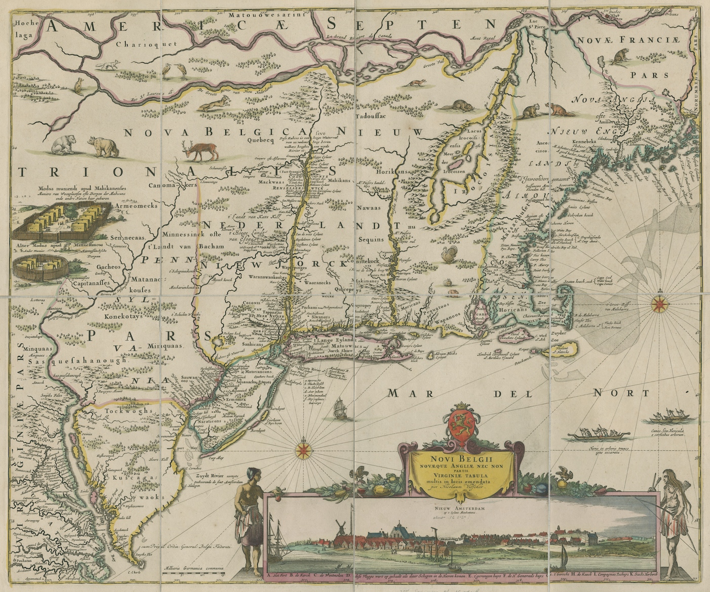
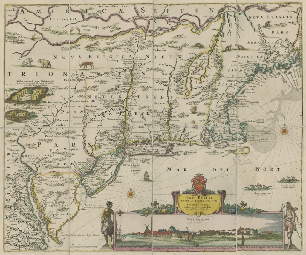
- Nicolaes Visscher, “Novi Belgii Novaeque Angliae nec non partis Virginiae tabula multis in locis emendata per Nicolaum Visscher [New Netherland New England…],” Circa 1690. (Full map.)
About the Author
Nicholas Kryczka is a Postdoctoral Fellow in the Social Sciences and the Department of History at the University of Chicago. He teaches coursework in American Civilization, urban history, and oral history and conducts research on the history of post-civil rights school reform in Chicago. Previously, Nick worked for a decade as a high school social studies teacher in the Chicago Public Schools.
Related Classroom Materials
Maps and the Beginnings of Colonial North America: C3 Activity (Grades 9-12)
Curriculum Connections: American Imperialism, Colonial & Revolutionary Period, Close Reading, Maps, Visual Literacy
Maps and the Beginnings of Colonial North America Collection Essay
Maps and the Beginnings of Colonial North America: Visual Literacy Class Activity (Grades K-8)
Curriculum Connections: European Imperialism, Geography, Maps, Visual Literacy
Maps and the Beginnings of Colonial North America: Unit Plan (Grades 6-12)
Curriculum Connections: American Imperialism, European Imperialism, Colonial and Revolutionary Period, Maps, Visual Literacy


